- Entertainment
- Exterior Comms System
- GMDSS
- Interior Communication Systems
- Radios - Handheld
- Radios - Shipboard
- Inmarsat-C Solutions
- Satcom L-Band Broadband
- Satcom VSAT (ESA Flat Panel)
- Satcom VSAT (Ka)
- Satcom VSAT (Ku)
- Satcom Networking & Security
- Satellite Phones
- SatCom Accessories
- — Iridium
- — Inmarsat
- Satellite Airtime Partners
- Sound Reception Systems
- Weatherfax
- End of Life - Communication
- AIS
- AutoPilot
- Catch Management
- Chart Plotters
- Depth & Echosounders
- Entertainment
- EPIRBS
- GPS & Satellite Compass
- Monitors & MFDs
- Radar
- Radios – Handheld
- Radios – Shipboard
- SARTS
- Satellite Phones
- Satcom Accessories
- — Iridium
- — Inmarsat
- Satcom L-Band
- Satcom Network - Fishing
- Satcom VSAT
- Sonar
- Subsea (SeaFloor Mapping)
- Vessel Monitoring Systems
- Trawl Gear
- End of Life - Fishing
- Satellite Phones
- SatCom KITS
- SatCom Accessories
- — Iridium
- — Inmarsat
- Rentals
- Push-to-Talk (PTT)
- Portable BGAN
- Vehicular BGAN
- Iridium Certus® Fixed and Mobile
- VSAT - ESA Flat Panel
- VSAT - Parabolic
- M2M
- Satcom Networking & Security
- Satellite Airtime Partners
- Firmware Downloads
- End of Life - Land Mobile SatCom
Subsea (SeaFloor Mapping)
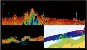
Olex – 3D Mapping & Plotting System
Olex is an innovative software program for navigation, fishing and surveying. Uniquely running on a very stable Linux-based platform, Olex utilizes a dedicated processor; the new M4 fan-less Computer with solid-state hard drive and WiFi. (pdf specs)
Olex systems interface with any NMEA single-beam sounder, Atec Multibeam, WASSP & most Simrad Multibeam units. Great Optional Features: Bottom Hardness, Weather, AIS, Trawl Position. Plus, FREE Software Updates!
SEEING is BELIEVING – Click on Mackay’s dedicated You-Tube Channel for in-depth Olex System videos showcasing the impressive ocean-floor details, extensive capabilities & ease-of-use.
Olex’s SHARED Global Bottom Data, FREE to Fellow Olex Users, is the Highest Quality on the Market. You Can’t Afford to Fish Without OLEX!
Contact Mackay Marine’s dedicated-Olex Team* at Olex@mackaymarine.com for complete details and applications, or call Seattle WA +1 206 282 8080 or Halifax, NS +1 902 468 8480.
*Mackay is the exclusive North American Olex representative
and supports many other global markets.
-
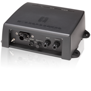
Furuno DFF-3D Fish Finder
Read more -
Furuno WASSP F3 Series MultiBeam Sonar – System Options
Read more -

Nobeltec TimeZero Coastal Monitoring System
Read more -
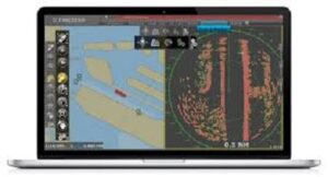
Nobletec TIMEZERO (TZ) Professional
Read more -
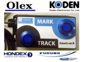
Olex Fastrack Remote
Read more -
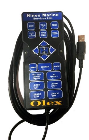
Olex HMS Remote
Read more -
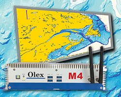
Olex M3 and M4 Computer 128GB Hard Drive
Read more -

Olex Software and System Detail
Read more -

OLEX Sounder Module OS1
Read more -
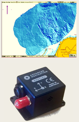
Olex Spatial All-in-One Sensor
Read more -
TIMEZERO (TZ) Navigator
Read more
- Entertainment
- Exterior Comms System
- GMDSS
- Interior Communication Systems
- Radios - Handheld
- Radios - Shipboard
- Inmarsat-C Solutions
- Satcom L-Band Broadband
- Satcom VSAT (ESA Flat Panel)
- Satcom VSAT (Ka)
- Satcom VSAT (Ku)
- Satcom Networking & Security
- Satellite Phones
- SatCom Accessories
- — Iridium
- — Inmarsat
- Satellite Airtime Partners
- Sound Reception Systems
- Weatherfax
- End of Life - Communication
- AIS
- AutoPilot
- Catch Management
- Chart Plotters
- Depth & Echosounders
- Entertainment
- EPIRBS
- GPS & Satellite Compass
- Monitors & MFDs
- Radar
- Radios – Handheld
- Radios – Shipboard
- SARTS
- Satellite Phones
- Satcom Accessories
- — Iridium
- — Inmarsat
- Satcom L-Band
- Satcom Network - Fishing
- Satcom VSAT
- Sonar
- Subsea (SeaFloor Mapping)
- Vessel Monitoring Systems
- Trawl Gear
- End of Life - Fishing
- Satellite Phones
- SatCom KITS
- SatCom Accessories
- — Iridium
- — Inmarsat
- Rentals
- Push-to-Talk (PTT)
- Portable BGAN
- Vehicular BGAN
- Iridium Certus® Fixed and Mobile
- VSAT - ESA Flat Panel
- VSAT - Parabolic
- M2M
- Satcom Networking & Security
- Satellite Airtime Partners
- Firmware Downloads
- End of Life - Land Mobile SatCom